Our Radar Control Solutions provide a complete, modular framework for radar simulation, visualization, and tracking. Designed for training, testing, and operational environments, this suite includes tools for generating realistic radar video, visualizing radar returns over geographic maps, and managing target tracking across multiple sensors. Whether for naval command centers, surveillance platforms, or system development labs, these solutions offer flexibility, accuracy, and seamless integration to meet modern radar operation needs.
Radar Simulator
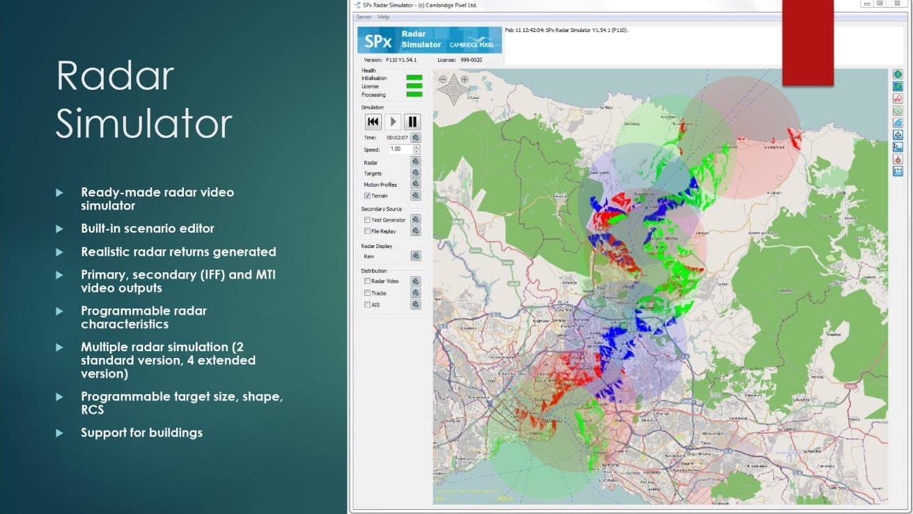
Radar Simulator provides a complete, configurable environment for generating radar video and training scenarios with high fidelity. Below are its key features explained:
- Ready-made radar video simulation
Offers an out-of-the-box radar simulation environment with no complex setup required. Ideal for training, testing, and demonstration purposes. - Built-in scenario editor
Includes a graphical interface to create and modify simulation scenarios, allowing users to define target movements, radar settings, and environmental conditions. - Realistic radar returns generated
Simulates accurate radar reflections, including clutter, noise, and Doppler effects, to closely mimic real-world radar behavior. - Primary, secondary (IFF), and MTI video outputs
Supports generation of standard radar outputs:- Primary (object detection)
- Secondary/IFF (Identification Friend or Foe)
- MTI (Moving Target Indicator) for dynamic targets
- Programmable radar characteristics
Customize radar parameters such as beam width, pulse rate, scan speed, and antenna rotation to emulate different radar types. - Multiple radar simulation
Allows simulation of up to 2 radars in the standard version, or up to 4 in the extended version—each with independent settings and behaviors. - Programmable target size, shape, and RCS
Define target attributes such as size, silhouette, and radar cross-section (RCS) to study detection sensitivity and tracking behavior. - Support for buildings and structures
Simulates fixed terrain features or obstacles that affect radar propagation, enhancing realism for urban or coastal scenarios.
Radar View
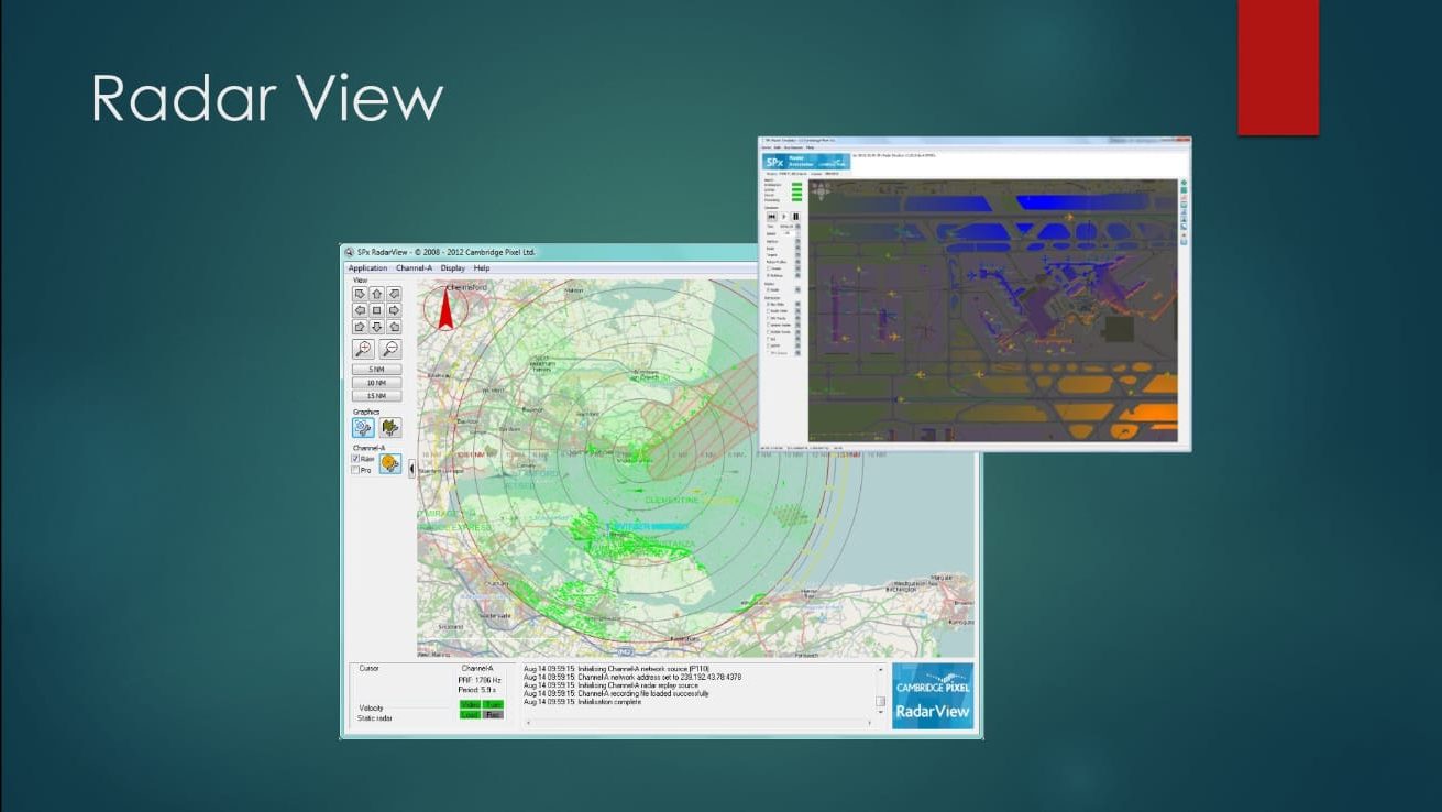
Radar View is the visualization and monitoring interface for real or simulated radar data, providing operators with intuitive and informative situational awareness.
- Live radar display over map
Shows real-time radar video and track data over georeferenced maps, satellite imagery, or navigation charts. - Overlay of simulated or real targets
Supports display of both live and simulated targets, allowing users to switch between training and operational modes seamlessly. - Interactive controls
Users can zoom, pan, and customize display layers, enhancing clarity and usability in training or operations. - Supports input from simulator or real radar
Compatible with Radar Simulator output or live radar feeds, making it suitable for hybrid systems or operator training. - Used for training and evaluation
Designed for simulation centers and control rooms to train personnel or evaluate radar performance under various scenarios.
Tracking Server (Radar Server)
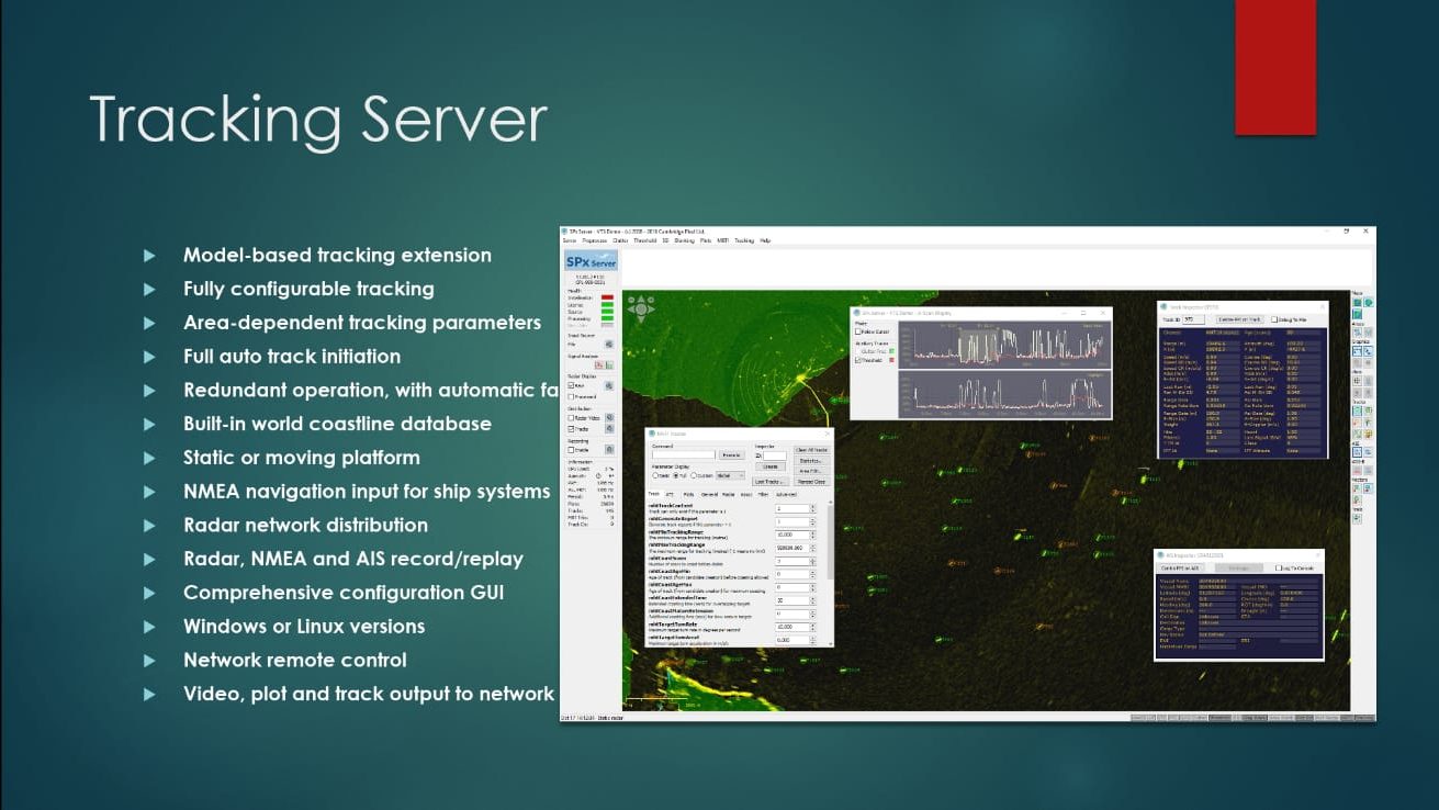
Tracking Server (also referred to as Radar Server) processes radar data, fuses sensor inputs, and generates accurate, real-time tracks for operational awareness and command systems.
- Model-based tracking extension
Uses physical and behavioral models to enhance tracking accuracy, especially in cluttered or multi-target environments. - Fully configurable tracking
Offers advanced parameters for adjusting how tracks are initiated, maintained, and filtered based on operational needs. - Area-dependent tracking parameters
Allows different zones to have different tracking logic (e.g., sensitive areas vs. open sea), improving system performance and relevance. - Full auto track initiation
Automatically detects and starts tracking new targets without manual input, enabling efficient surveillance. - Redundant operation with failover
Built-in redundancy mechanisms ensure continuous tracking in the event of hardware or network failure. - Built-in world coastline database
Includes geographic shoreline data to support context-aware tracking near land or coastlines. - Static or moving platform support
Can operate from land-based stations or onboard moving platforms (ships, vehicles, aircraft) with real-time adjustments. - NMEA navigation input for ship systems
Integrates vessel navigation data (e.g., heading, speed, position) for platform stabilization and alignment. - Radar network distribution
Distributes radar video and track data to multiple clients across a network for shared situational awareness. - Radar, NMEA, and AIS record/replay
Records all sensor data for playback, analysis, and after-action review. - Comprehensive configuration GUI
Features a user-friendly graphical interface for setup, parameter tuning, and system monitoring. - Cross-platform support
Available for both Windows and Linux environments. - Remote control over network
Allows remote operation and monitoring through secure network connections. - Video, plot, and track output to network
Outputs radar video, target plots, and track data to external systems, control centers, or training environments.